Category:Dartry Mountains
Jump to navigation
Jump to search
English: The Dartry Mountains are a range in the north west of Ireland. They are situated mainly on the border of County Sligo and County Leitrim.
mountain range in north-west Ireland  | |||||
| Upload media | |||||
| Instance of | |||||
|---|---|---|---|---|---|
| Location |
| ||||
| Highest point | |||||
| Elevation above sea level |
| ||||
 | |||||
Subcategories
This category has the following 5 subcategories, out of 5 total.
Media in category "Dartry Mountains"
The following 110 files are in this category, out of 110 total.
-
 Aerial Benbulbin.jpg 4,096 × 2,730; 5.28 MB
-
 Ben Bulben 001.jpg 4,032 × 3,024; 6.58 MB
-
 Benbulben from mullaghmore.jpg 720 × 479; 46 KB
-
 Cliffs of Annacoona - geograph.org.uk - 1150963.jpg 640 × 426; 247 KB
-
 Cliffs of Annacoona.jpg 5,312 × 2,988; 6.51 MB
-
 Cottage along Gleniff Horseshoe Drive - geograph.org.uk - 1150959.jpg 640 × 426; 285 KB
-
 Dartry Mountains, Sligo.jpg 3,572 × 2,372; 885 KB
-
 Dartrys from Mullaghmore.jpg 4,056 × 2,280; 3.88 MB
-

-

-
 Dough Mountain - geograph.org.uk - 1494928.jpg 640 × 479; 59 KB
-
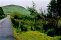
 Driving to Gleniff Horseshoe Drive - geograph.org.uk - 1165470.jpg 640 × 426; 335 KB
-
 Field near Benwisken - geograph.org.uk - 1149307.jpg 639 × 426; 338 KB
-

-
 Glenade Townland - geograph.org.uk - 1482651.jpg 640 × 479; 67 KB
-
 Glencar Lough 001.jpg 2,853 × 2,140; 2.7 MB
-
 Glencar Lough 002.jpg 4,000 × 2,250; 8.81 MB
-
 Glencar Lough 003.jpg 4,000 × 2,250; 5.19 MB
-
 Glencar Waterfall 001.jpg 3,456 × 5,184; 4.73 MB
-
 Glencar Waterfall 002.jpg 5,184 × 3,456; 4.83 MB
-
-
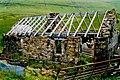
 Gleniff Horseshoe Drive - Building - geograph.org.uk - 1350675.jpg 640 × 427; 85 KB
-

-

-

-
-

-

-

-
-

-

-
 Gleniff Horseshoe Drive - geograph.org.uk - 1149159.jpg 640 × 425; 271 KB
-
 Gleniff Horseshoe Drive - geograph.org.uk - 1149192.jpg 640 × 425; 298 KB
-
 Gleniff Horseshoe Drive - geograph.org.uk - 1149206.jpg 640 × 425; 263 KB
-
 Gleniff Horseshoe Drive - geograph.org.uk - 1149254.jpg 640 × 425; 253 KB
-
 Gleniff Horseshoe Drive - geograph.org.uk - 1150966.jpg 640 × 426; 225 KB
-
 Gleniff Horseshoe Drive - geograph.org.uk - 1350670.jpg 640 × 427; 104 KB
-
 Gleniff Horseshoe Drive - geograph.org.uk - 1350671.jpg 640 × 427; 86 KB
-
 Gleniff Horseshoe Drive - geograph.org.uk - 1350672.jpg 640 × 427; 116 KB
-
 Gleniff Horseshoe Drive - geograph.org.uk - 1350673.jpg 640 × 427; 112 KB
-
 Gleniff Horseshoe Drive - geograph.org.uk - 1350674.jpg 640 × 427; 92 KB
-
 Gleniff Horseshoe Drive - geograph.org.uk - 1350680.jpg 640 × 427; 95 KB
-
 Gleniff Horseshoe Drive - geograph.org.uk - 1350681.jpg 640 × 427; 87 KB
-
 Gleniff Horseshoe Drive - geograph.org.uk - 1350682.jpg 427 × 640; 97 KB
-
 Gleniff Horseshoe Drive - geograph.org.uk - 1350685.jpg 640 × 427; 101 KB
-
 Gleniff Horseshoe Drive - House - geograph.org.uk - 1165395.jpg 639 × 426; 406 KB
-
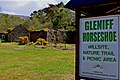 Gleniff Horseshoe Drive - Millsite - geograph.org.uk - 1165347.jpg 640 × 426; 373 KB
-

-

-
-

-
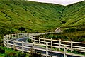
 Gleniff Horseshoe Drive - Roadscene - geograph.org.uk - 1351877.jpg 640 × 427; 110 KB
-
 Gleniff Horseshoe Drive - Roadscene - geograph.org.uk - 1351878.jpg 640 × 427; 92 KB
-
 Gleniff Horseshoe Drive - Roadscene - geograph.org.uk - 1351881.jpg 640 × 427; 97 KB
-
 Gleniff Horseshoe Drive - Stream - geograph.org.uk - 1350683.jpg 427 × 640; 127 KB
-
 Gleniff Horseshoe Drive - Waterfall - geograph.org.uk - 1165427.jpg 640 × 426; 361 KB
-
 Gleniff Horseshoe Drive entrance - geograph.org.uk - 1154431.jpg 639 × 426; 359 KB
-
 Gleniff Horseshoe Drive in mist - geograph.org.uk - 1150962.jpg 640 × 426; 271 KB
-
 Gleniff Horseshoe Valley.jpg 4,160 × 3,120; 3.71 MB
-
 Keep Out^ Gleniff. - geograph.org.uk - 135966.jpg 534 × 308; 25 KB
-
 Limestone cliffs, head of Gleniff. - geograph.org.uk - 135963.jpg 541 × 307; 29 KB
-

-

-
 Near Dough Mountain - geograph.org.uk - 1494908.jpg 640 × 479; 60 KB
-
 Near glencar lough.jpg 1,280 × 960; 278 KB
-
 Sliabh Duch (Dough Mountain) - geograph.org.uk - 1494927.jpg 640 × 479; 61 KB
-
 Sligo Holiday.jpg 5,297 × 3,235; 9.87 MB
-
 Sligo Ireland 1.jpg 5,912 × 3,947; 9.4 MB
-
 Sligo Ireland 10.jpg 5,891 × 3,809; 16.23 MB
-
 Sligo Ireland 11.jpg 5,918 × 3,766; 15 MB
-
 Sligo Ireland 12.jpg 5,864 × 3,723; 11.25 MB
-
 Sligo Ireland 13.jpg 5,905 × 3,798; 15.88 MB
-
 Sligo Ireland 14.jpg 3,964 × 5,753; 13.79 MB
-
 Sligo Ireland 15.jpg 3,431 × 5,277; 12.98 MB
-
 Sligo Ireland 16.jpg 3,807 × 5,918; 15.28 MB
-
 Sligo Ireland 17.jpg 5,852 × 3,462; 16.11 MB
-
 Sligo Ireland 18.jpg 5,991 × 3,958; 19.88 MB
-
 Sligo Ireland 19.jpg 5,743 × 3,834; 15.03 MB
-
 Sligo Ireland 2.jpg 5,951 × 3,788; 14.9 MB
-
 Sligo Ireland 20.jpg 3,770 × 5,401; 15.6 MB
-
 Sligo Ireland 21.jpg 4,016 × 6,016; 5.89 MB
-
 Sligo Ireland 22.jpg 5,907 × 3,943; 14.1 MB
-
 Sligo Ireland 23.jpg 3,912 × 5,860; 22.49 MB
-
 Sligo Ireland 24.jpg 3,764 × 5,203; 10.62 MB
-
 Sligo Ireland 25.jpg 3,959 × 5,931; 19.3 MB
-
 Sligo Ireland 26.jpg 5,913 × 3,947; 15.73 MB
-
 Sligo Ireland 27.jpg 5,352 × 3,817; 16.48 MB
-
 Sligo Ireland 28.jpg 3,960 × 5,687; 15.86 MB
-
 Sligo Ireland 29.jpg 5,879 × 3,925; 21.7 MB
-
 Sligo Ireland 3.jpg 6,016 × 4,016; 13.46 MB
-
 Sligo Ireland 30.jpg 3,903 × 5,656; 24.51 MB
-
 Sligo Ireland 4.jpg 3,776 × 5,641; 7.92 MB
-
 Sligo Ireland 5.jpg 5,951 × 3,973; 6.96 MB
-
 Sligo Ireland 6.jpg 5,951 × 3,870; 7.58 MB
-
 Sligo Ireland 7.jpg 3,987 × 5,973; 22.26 MB
-
 Sligo Ireland 8.jpg 3,900 × 5,627; 15.12 MB
-
 Sligo Ireland 9.jpg 5,976 × 3,907; 20.11 MB
-
 Sligo Ireland.jpg 5,897 × 3,711; 9.25 MB
-
 Sligo Vacation.jpg 5,955 × 3,609; 14.47 MB
-
 Sligo, Benbulbin, Gleniff Valley Old Mine Track - geograph.org.uk - 1949180.jpg 3,648 × 2,736; 2.89 MB
-
 Sligo, Benbulbin, Gleniff Valley Old Mine Track - geograph.org.uk - 1953893.jpg 3,648 × 2,736; 3.78 MB
-
 Sligo, Benbulbin, Gleniff Valley Old Mine Track. - geograph.org.uk - 1945436.jpg 3,648 × 2,736; 3.41 MB
-
 Sligo. Benbulbin. "The Cliffs Of Annacoona" - geograph.org.uk - 2001361.jpg 3,648 × 2,736; 3.71 MB
-
 The Glenade Valley and Eagle's Rock.jpg 4,032 × 3,024; 2.73 MB
-
 Tievebaun Mtn 01.png 946 × 398; 662 KB
-
 Tievebaun Mtn 02.jpg 4,032 × 3,024; 3.07 MB
-
 Truskmore - geograph.org.uk - 1154522.jpg 639 × 388; 270 KB
-
 Truskmore and Cliffs of Annacoona - geograph.org.uk - 1154505.jpg 640 × 426; 315 KB
-


_-_geograph.org.uk_-_1494927.jpg)


